by Ji-cing Guo
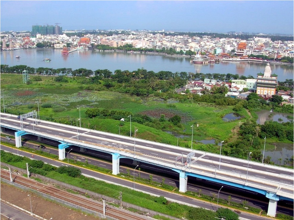
Jhouzih Wetland and Lotus Pond in August 2006
Many people have no idea where the water sources of the Lotus Pond come from.
According to the Fengshan Prefecture Interview Book, “Lotus Flower Pond is located in Singlong Village. It measures about 5 kilometers in circumference. There is a living spring at the center, which serves as the reservoir pond for the temples. When the lotuses are in full bloom, the fragrance travels several kilometers, making it one of the eight attractions of the Lotus Pond.” According to geo-archaeological evidence, approximately 1,000 years ago, areas stretching from the Lotus Pond to the hills in Dashu in the east and to present-day Aozidi in the south were all part of the “ancient Kaohsiung bay.” As the seawater receded, ponds and canals formed in low-lying areas. In that sense, the Lotus Pond, Neiwei Pond, Jinshi Lake, Shezilin Pond, Amituo Pond, Caigong Pond, Kezi Pond, Cifan Pond, Love River, and Nanhai Big Canal in the district are all historical relics resulting from changes in the geological process.
With “a living spring at the center,” the Lotus Pond has never dried up, providing year-round access to water for domestic use to residents in the “Zuoying Community” in the early days. However, as more Han Chinese immigrants flocked into the areas, the demand for water for rice cultivation surged, and the water supply from the “natural living spring” of the Lotus Pond became insufficient. In the 22nd year of the reign of Emperor Daoguang of the Qing Dynasty (1842), local gentry, including Lan Jheng and Syuan-jhih Jheng, completed the Caogong New Canals excavation project planned by Magistrate Jin Cao. The project involved expanding the Lotus Pond and building canals to draw water from the pond to irrigate several thousand square meters of farmland in the surrounding areas, transforming Singlong Village into a prosperous area with an abundance of food and clothing. The water source of the Caogong New Canals originated from the Three-spillway Watergate in Jioucyutang, located just 500 meters away from the Five-spillway Watergate for the Caogong Old Canals. The main channel of the Caogong New Canals ran westward from the south of the hills in Dashu to the Lotus Pond located 15 kilometers away. The Three-spillway Watergate is at an elevation of 19 meters, while the Lotus Pond, which is located at the farthest end of the new canals, is at an elevation of 5.1 meters. The main channel had to be built at a higher elevation to ensure that it could extend far enough for irrigation purposes.
After more than 180 years since the construction of the Caogong New Canals, the main channel maintains its original course, with only minor changes at the beginning and end sections. This has made the channel a legendary historic relic in modern times. The Three-spillway Watergate of the Caogong New Canals was built in the 24th year of the reign of Emperor Daoguang (1844). It is located 500 meters upstream of the old canals and shares the same structure as that of the old canals. It remained in operation as the water inlet for the new canals during the Japanese Colonial Period. In 1951, an electric water pumping station (now known as the Caogong Canal Jiouchiu Water Pumping Station) was built near the south of the head of the old canals to extract water. The water passage between the head of the new Canals and the Caogong First Bridge therefore ceased operation. The land was subsequently sold by Kaohsiung Irrigation Association as wasteland. Currently, the land where the Three-spillway Watergate is located is privately owned and is undergoing rezoning for factory construction. Through negotiations by the Kaohsiung City Cultural Bureau, the Three-spillway Watergate has been preserved. The three reinforced concrete gates, constructed during the Japanese Colonial Period, and the engraving that reads “New Canal Watergate” on the horizontal frame, remain visible to this day. Among the new canals, the Jhouzihyangban Canal extended to the Banpingshan Mountain and then flowed into the Lotus Pond via the Jhouai Community. The canal was later replaced by the Jhouzihyang Canal built during the Japanese Colonial Period. The newly-built canal passed through what is now the Indigenous Botanical Garden and then flowed into the Locus Pond via the culverts under the Western Trunk Railway Line. In 2022, as part of the tunnel excavation work of the Underground Railway Project, the underground culverts were replaced, and the Caogong New Canals flowed to the Lotus Pond via the water inlet pools on the ground instead.
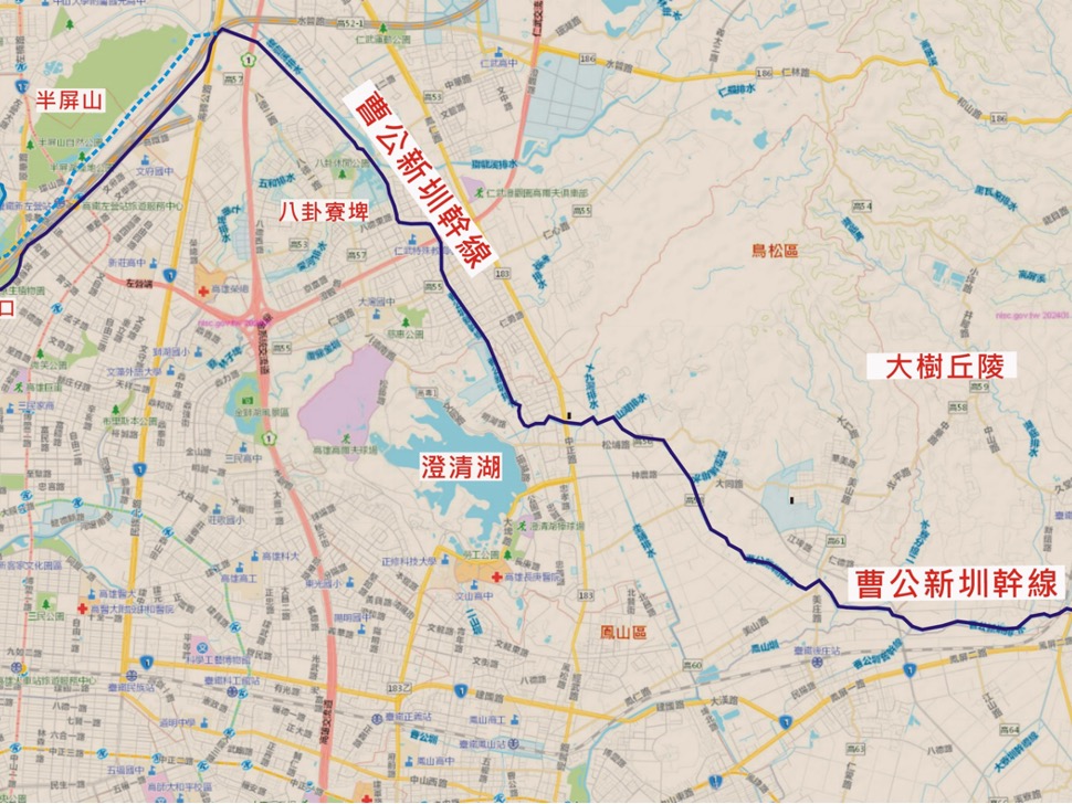
The map of the main channel of the Caogong New Canals (A snapshot of Google Map with labels added by Ji-cing Guo)
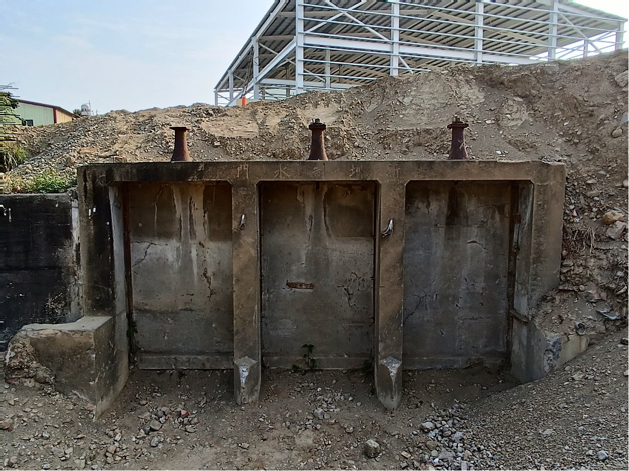
The current status of the Tree-spillway Watergate of the Caogong New Canals photographed by Ji-cing Guo
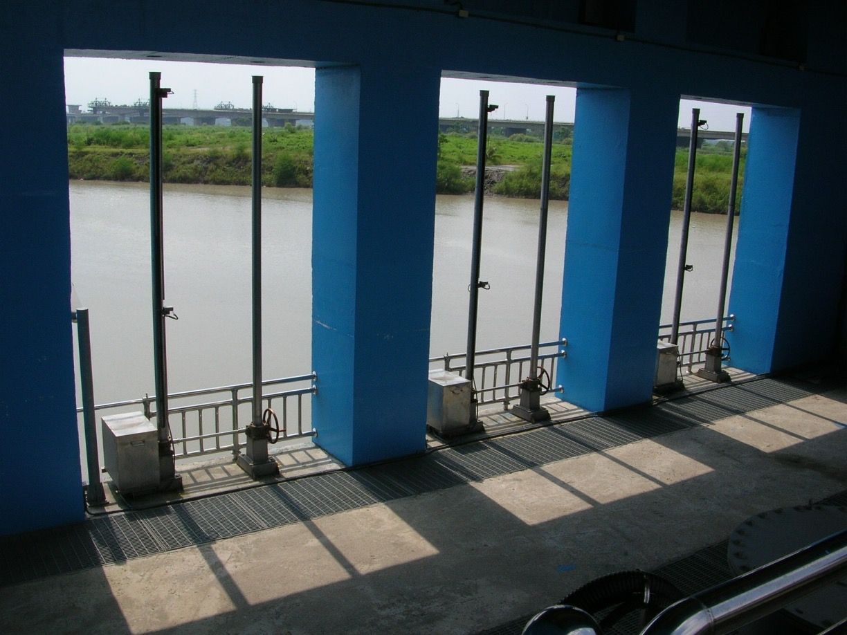
Caogong Canal Jiouchiu Water Pumping photographed by Ji-cing Guo
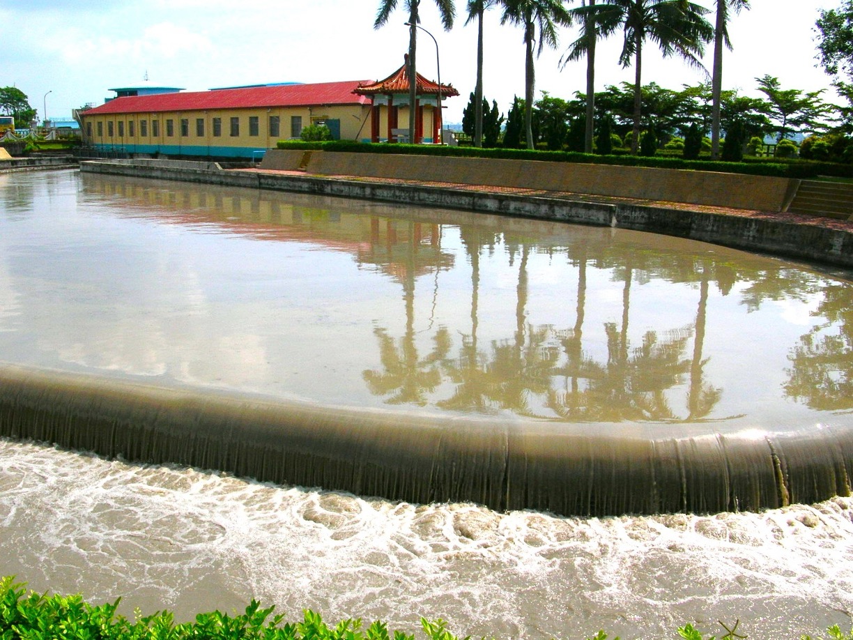
Sedimentation Basin of the Jiouchiu Water Pumping Station photographed by Ji-cing Guo
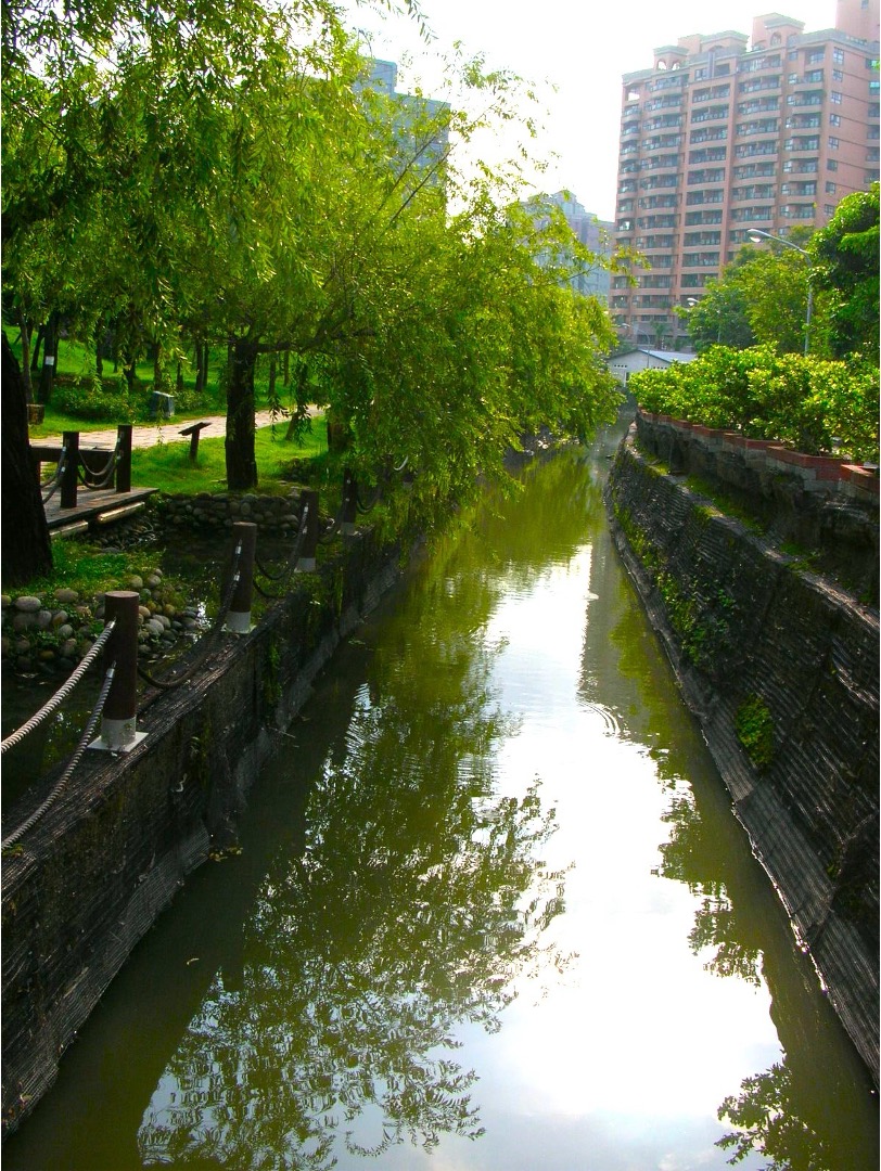
The canal that passes through the Indigenous Botanical Garden photographed by Ji-cing Guo
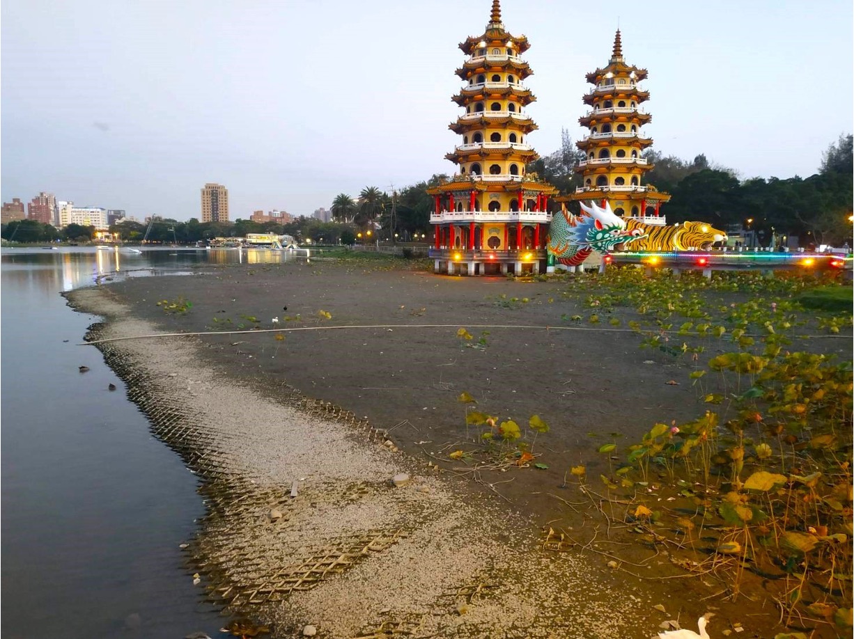
The drying up Lotus Pond photographed by Ji-cing Guo
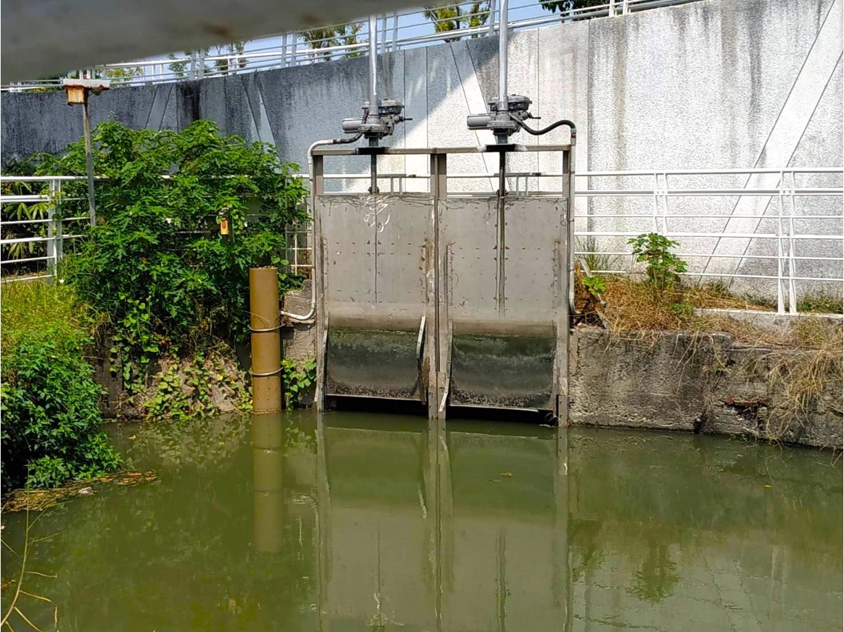
The wategate of the Caogong New Canals in the Indigenous Botanical Garden photographed by Ji-cing Guo
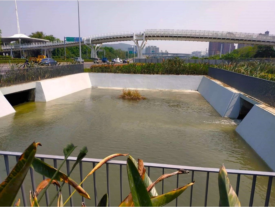
The water inlet pool at the Lotus Pond in the Green Corridor photographed by Ji-cing Guo
As described above, during the Qing Dynasty, ponds of various sizes dotted present-day Zuoying District. The Caogong New Canals interconnected these ponds to form an extensive irrigation system, transforming the land into fertile farms and contributing to the increase in agricultural productivity and the growth of population in Zuoying. There was once a wide expanse of rice paddies to the east of the Jhouzi Community. When the breeze swept through, the rice plants swayed, creating the illusion of rolling waves. The mesmerizing beauty of the rice paddies inspired names such as “Jhouziyang” and “Dayangtian,” both implying that the rice paddies resembled oceans. Among these ponds, the Lotus Pond, Neiwei Pond (shrunk), Jinshi Lake, Shezilin (shrunk), and Cifan Pond (strunk) remain today. Others, including Amituo Pond (now the Singuang Elementary School and Zuoying Junior High School), Caigong Pond (now the Fushan Elementary School, Fushan Junior High School, and Hsin Chuang Senior High School), and Kezi Pond (now the Smile Park and Freedom Sunset Marke) have been repurposed as schools or parks.
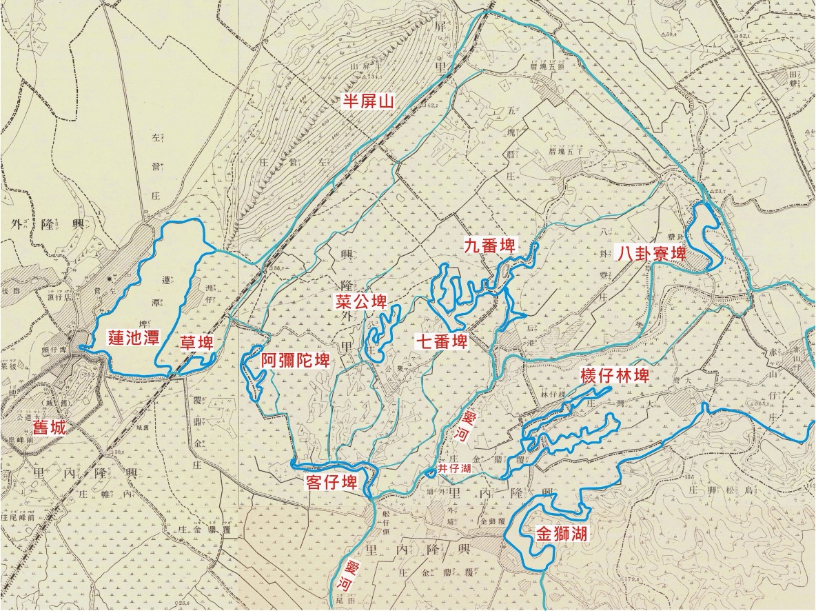
The distribution of ponds in Zuoying during the Japanese Colonial Period (A snapshot of 1904 Taiwan Hozu with labels added by Ji-cing Guo)
To accommodate rapid urban development, land in urban areas has become increasingly expensive. The preservation of cultural assets is often overshadowed by the imperative for economic growth. In this context, it requires the collective effort of exemplary urban citizens to advocate for and promote the preservation of canals and ponds, creating a quality urban living environment characterized by abundant water resources and green spaces!