Water Sources of the Lotus Pond and the Ponds in Zuoying
文、攝影/郭吉清
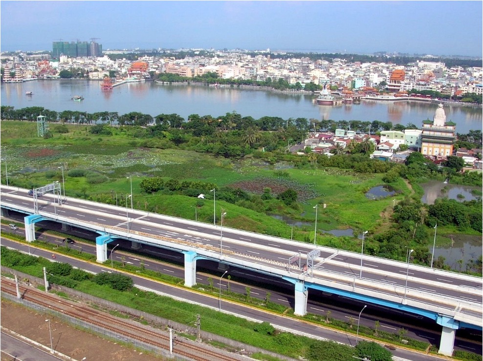
洲仔溼地與蓮池潭 (2006年8月)
Jhouzih Wetland and Lotus Pond in August 2006
蓮池潭的水源來自何處?許多人不瞭解。
Many people have no idea where the water sources of the Lotus Pond come from.
1894年《鳳山縣采訪冊》記載:蓮池潭在興隆里,周十里許,中有活泉,為聖廟泮池,每逢荷花盛開,香聞數里,昔人目為八景之一。依據地質考古證據顯示,距今約一千年前,蓮池潭與向東到大樹丘陵、向南到今凹子底的地區,皆是「古高雄灣」的範圍,海水降退後,低窪處形成埤塘與河溝。本區域內的蓮池潭、內惟埤、金獅湖、檨仔林埤、阿彌陀埤、菜公埤、客仔埤、七番埤、愛河、南海大溝等,今天看來都是「滄海桑田」時空變遷的歷史遺跡。
According to the Fengshan Prefecture Interview Book, “Lotus Flower Pond is located in Singlong Village. It measures about 5 kilometers in circumference. There is a living spring at the center, which serves as the reservoir pond for the temples. When the lotuses are in full bloom, the fragrance travels several kilometers, making it one of the eight attractions of the Lotus Pond.” According to geo-archaeological evidence, approximately 1,000 years ago, areas stretching from the Lotus Pond to the hills in Dashu in the east and to present-day Aozidi in the south were all part of the “ancient Kaohsiung bay.” As the seawater receded, ponds and canals formed in low-lying areas. In that sense, the Lotus Pond, Neiwei Pond, Jinshi Lake, Shezilin Pond, Amituo Pond, Caigong Pond, Kezi Pond, Cifan Pond, Love River, and Nanhai Big Canal in the district are all historical relics resulting from changes in the geological process.
蓮池潭因為「中有活泉」終年有水,不會乾涸,早期「左營社」原始居民人口數不多,供應生活用水無虞。隨著漢人移民大量擁入,水稻種植等大量農業用水,造成蓮池潭的「自然活泉」漸趨不足供應。清道光22年(1842年),鄉紳鄭蘭、鄭宣治等人,完成知縣曹瑾所規劃的「曹公新圳」圳道開鑿,對蓮池潭加以擴建,並開闢圳路引潭水灌溉四周的農田千餘甲,使興隆里成為豐衣足食的富裕之城。清代「曹公新圳」的水源頭,位於九曲堂的「三孔水門」,距離「曹公舊圳」的「五孔水門」只有500公尺。曹公新圳主幹道沿著大樹丘陵南邊向西前進,流到約15公里遠的蓮池潭。曹公新圳三孔進水口,標高為19公尺,離新圳頭最遠的蓮池潭標高為5.1公尺,如果主圳道不設在高程,則圳水無法到達如此遠。
With “a living spring at the center,” the Lotus Pond has never dried up, providing year-round access to water for domestic use to residents in the “Zuoying Community” in the early days. However, as more Han Chinese immigrants flocked into the areas, the demand for water for rice cultivation surged, and the water supply from the “natural living spring” of the Lotus Pond became insufficient. In the 22nd year of the reign of Emperor Daoguang of the Qing Dynasty (1842), local gentry, including Lan Jheng and Syuan-jhih Jheng, completed the Caogong New Canals excavation project planned by Magistrate Jin Cao. The project involved expanding the Lotus Pond and building canals to draw water from the pond to irrigate several thousand square meters of farmland in the surrounding areas, transforming Singlong Village into a prosperous area with an abundance of food and clothing. The water source of the Caogong New Canals originated from the Three-spillway Watergate in Jioucyutang, located just 500 meters away from the Five-spillway Watergate for the Caogong Old Canals. The main channel of the Caogong New Canals ran westward from the south of the hills in Dashu to the Lotus Pond located 15 kilometers away. The Three-spillway Watergate is at an elevation of 19 meters, while the Lotus Pond, which is located at the farthest end of the new canals, is at an elevation of 5.1 meters. The main channel had to be built at a higher elevation to ensure that it could extend far enough for irrigation purposes.
清代曹公新圳開鑿至今已有180餘年,主圳道除頭尾有些許改變外,其他則維持原來路線沒有更動,可謂現代城市歷史的傳奇故事。曹公新圳「三孔涵」進水口於道光24年(1844年)完成,位於在舊圳上游五百公尺處,水門形制與舊圳相同,日治時期新圳還是由此進水。民國40年之後,於舊圳圳頭南方不遠新建電動抽水站(今曹公圳九曲抽水站)取水,新圳圳頭至曹公一號橋之間的水道因而廢圳,土地由高雄農田水利會依廢地處理出售。目前「三孔水門」屬私人土地,正進行土地重劃建造廠房,經高雄市文化局協調,三孔水門得以保存下來,日治時期加蓋的三道鋼筋水泥閘門清晰可辨,橫架上刻有「新圳制水門」。曹公新圳來到半屏山的「洲子洋瓣圳」,原來由「洲子」聚落注入蓮池潭。日治時期改由新開鑿的「洲子洋圳」(今高鐵路) ,經目前的原生植物園,通過縱貫鐵路底下「暗渠」注入蓮池潭。2022年因鐵路地下化開鑿隧道,曹公新圳原來在鐵路底下的「暗渠」,改為地上的「進水池」方式注入蓮池潭。
After more than 180 years since the construction of the Caogong New Canals, the main channel maintains its original course, with only minor changes at the beginning and end sections. This has made the channel a legendary historic relic in modern times. The Three-spillway Watergate of the Caogong New Canals was built in the 24th year of the reign of Emperor Daoguang (1844). It is located 500 meters upstream of the old canals and shares the same structure as that of the old canals. It remained in operation as the water inlet for the new canals during the Japanese Colonial Period. In 1951, an electric water pumping station (now known as the Caogong Canal Jiouchiu Water Pumping Station) was built near the south of the head of the old canals to extract water. The water passage between the head of the new Canals and the Caogong First Bridge therefore ceased operation. The land was subsequently sold by Kaohsiung Irrigation Association as wasteland. Currently, the land where the Three-spillway Watergate is located is privately owned and is undergoing rezoning for factory construction. Through negotiations by the Kaohsiung City Cultural Bureau, the Three-spillway Watergate has been preserved. The three reinforced concrete gates, constructed during the Japanese Colonial Period, and the engraving that reads “New Canal Watergate” on the horizontal frame, remain visible to this day. Among the new canals, the Jhouzihyangban Canal extended to the Banpingshan Mountain and then flowed into the Lotus Pond via the Jhouai Community. The canal was later replaced by the Jhouzihyang Canal built during the Japanese Colonial Period. The newly-built canal passed through what is now the Indigenous Botanical Garden and then flowed into the Locus Pond via the culverts under the Western Trunk Railway Line. In 2022, as part of the tunnel excavation work of the Underground Railway Project, the underground culverts were replaced, and the Caogong New Canals flowed to the Lotus Pond via the water inlet pools on the ground instead.
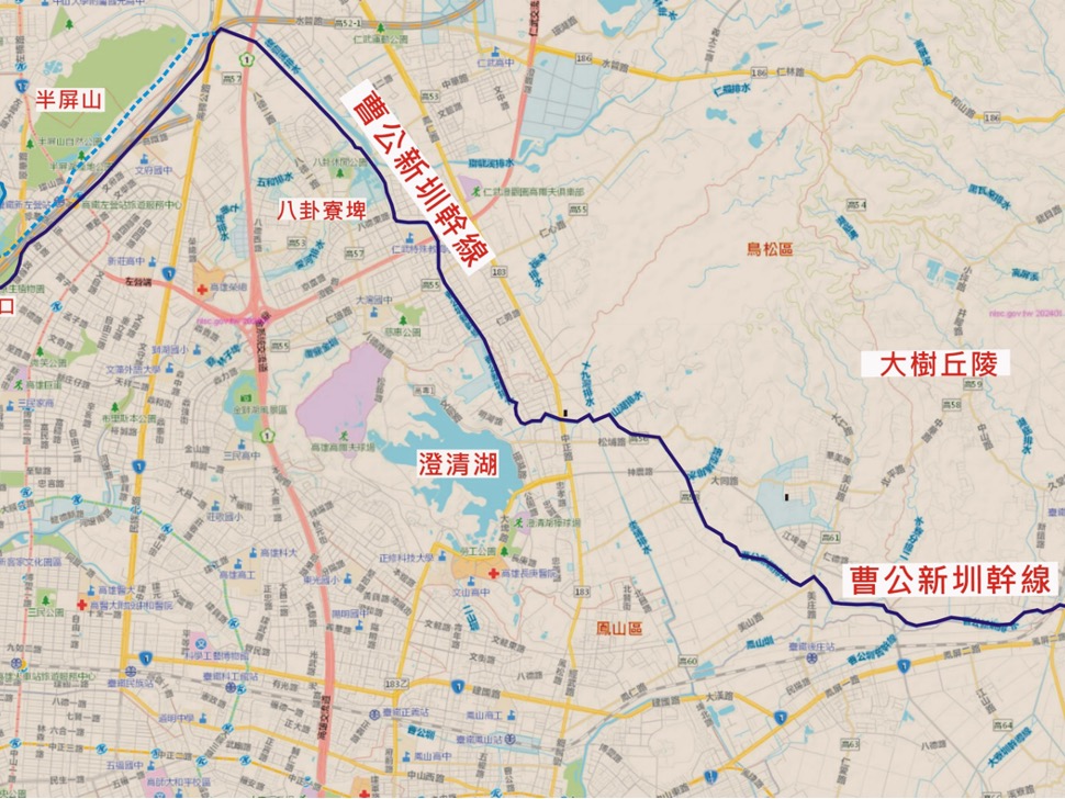
曹公新圳主幹道簡圖 (底圖﹕《google地圖》,郭吉清加註)
The map of the main channel of the Caogong New Canals (A snapshot of Google Map with labels added by Ji-cing Guo)
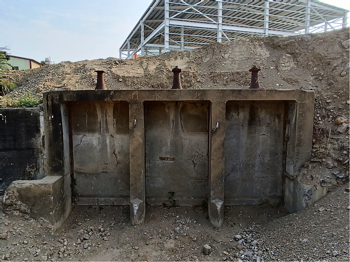
曹公新圳三孔水門現況
The current status of the Tree-spillway Watergate of the Caogong New Canals
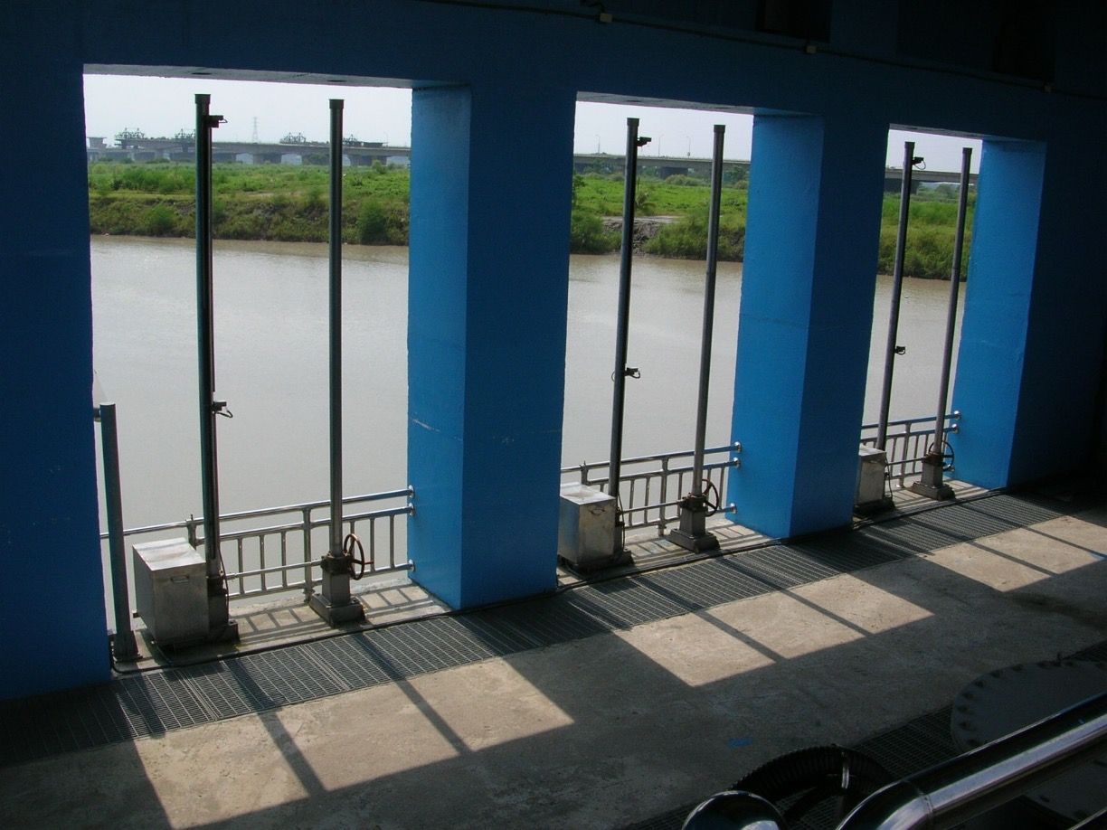
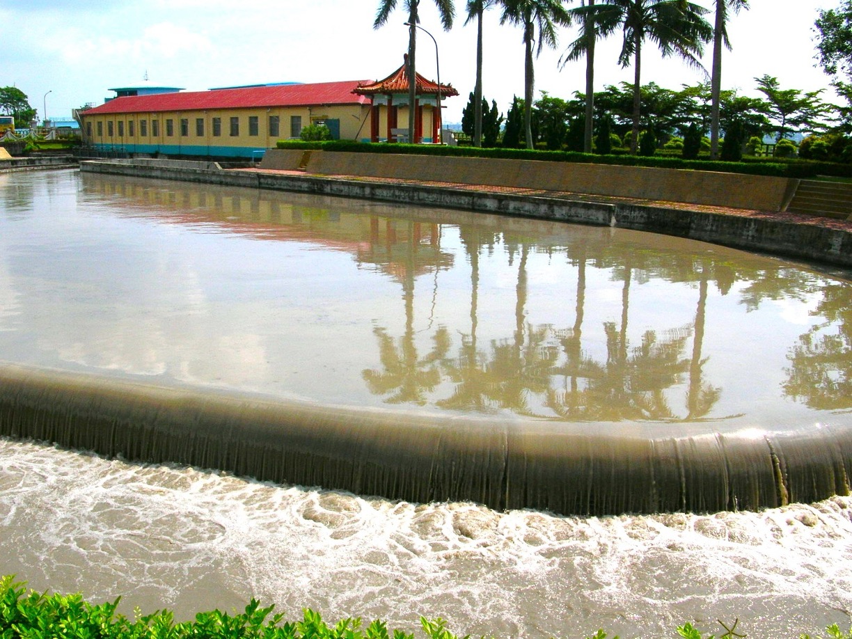
曹公圳九曲抽水站
Caogong Canal Jiouchiu Water Pumping Station
九曲抽水站沉沙池
Sedimentation Basin of the Jiouchiu Water Pumping Station
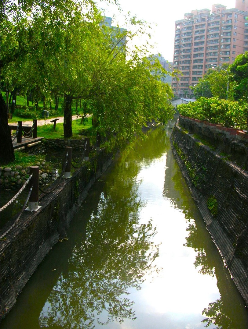
原生植物園曹公新圳
The canal that passes through the Indigenous Botanical Garden
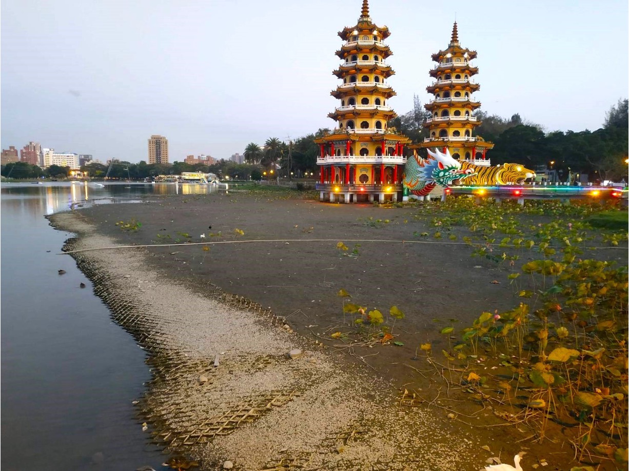
蓮池潭乾涸景況
The drying up Lotus Pond
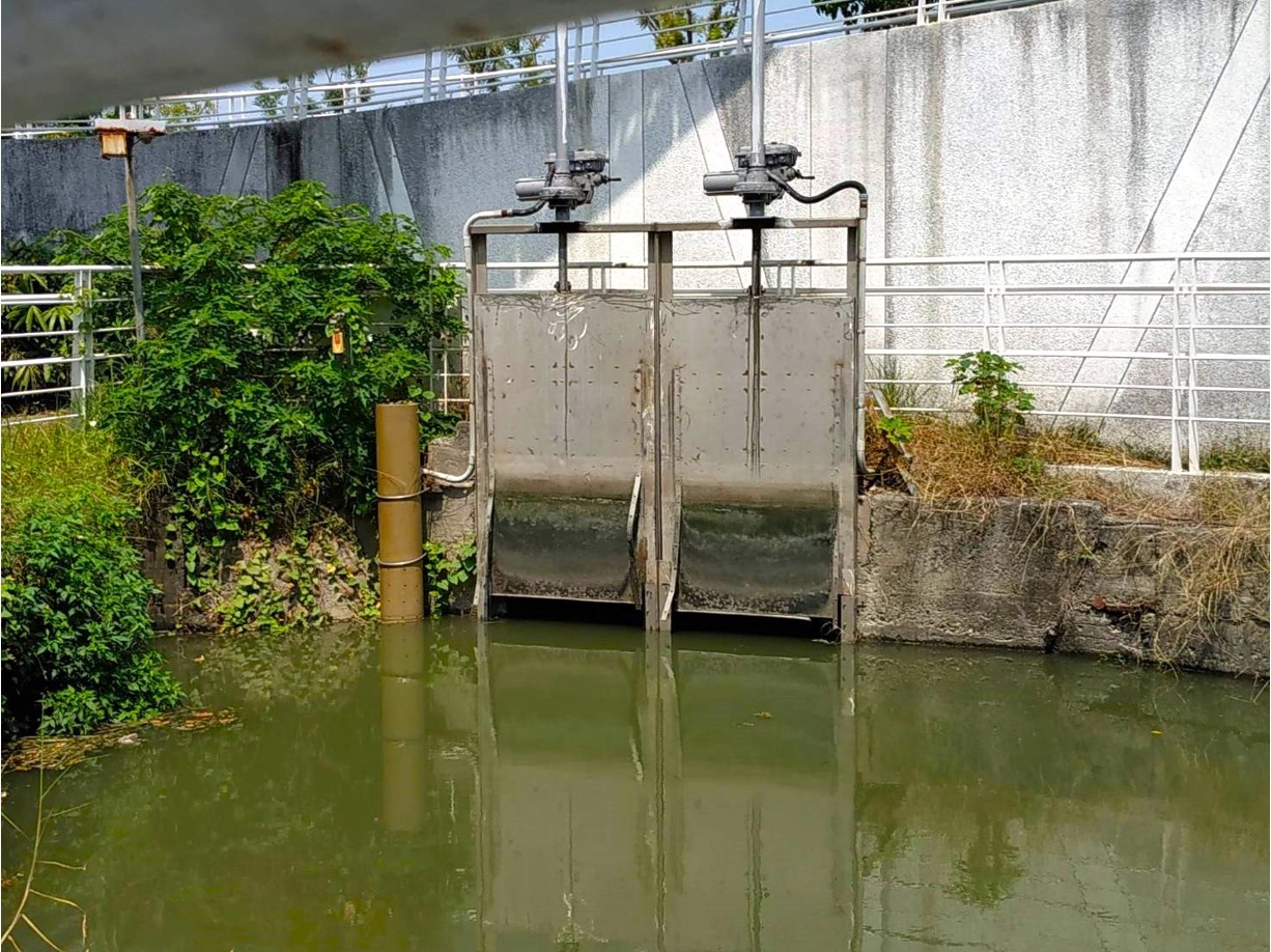
原生植物園曹公新圳閘門
The wategate of the Caogong New Canals in the Indigenous Botanical Garden
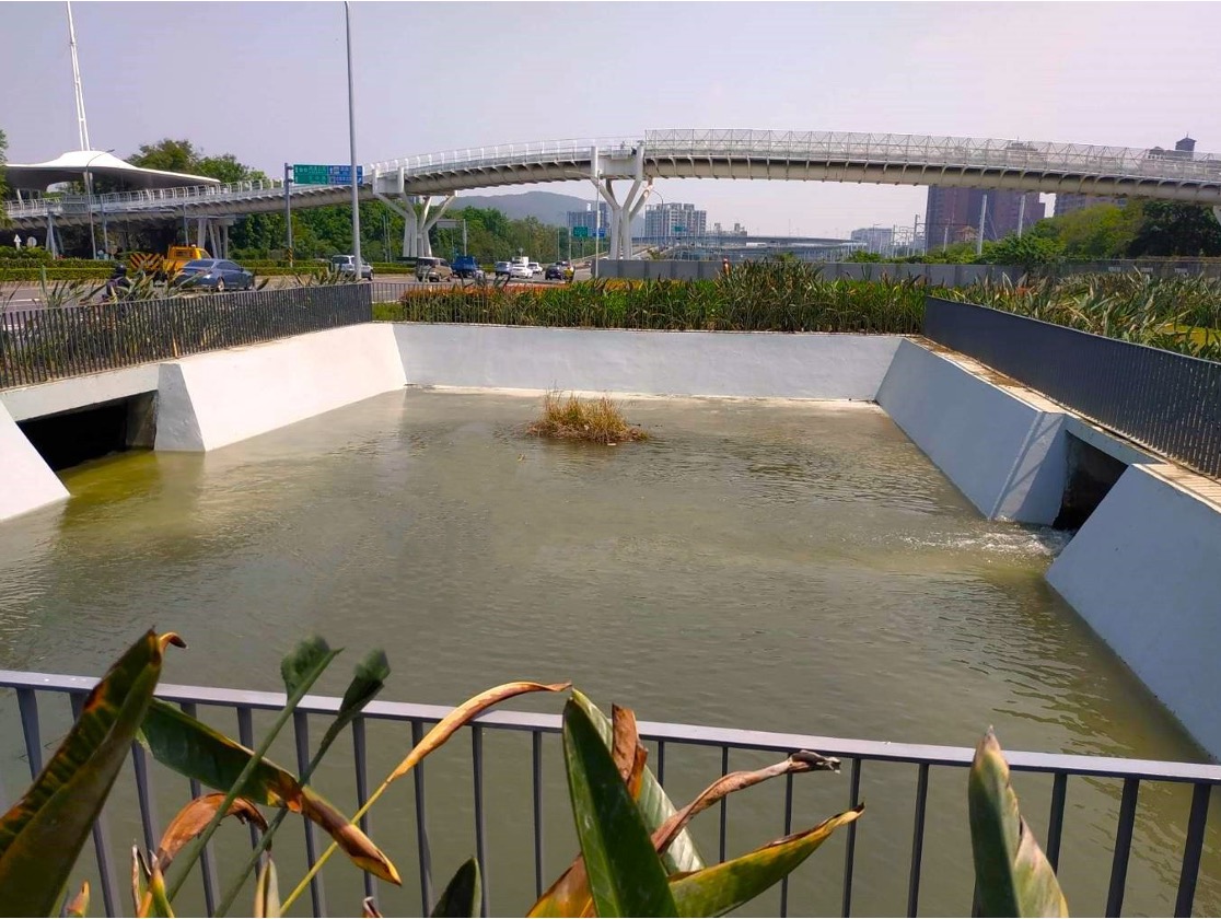
綠廊道蓮池潭進水池
The water inlet pool at the Lotus Pond in the Green Corridor
如前所述,清代左營地區遍布大小埤塘,曹公新圳的圳道將這些埤塘串聯起來,形成綿密的灌溉系統,土質肥沃的耕地,造就左營人的豐衣足食,聚落人口大量增加。洲仔聚落東邊的稻田一望無際,微風吹來有如海浪翻滾,這一大片水稻田因此稱為「洲仔洋」、又稱為「大洋田」,有如人間美景﹗這些大小埤塘,蓮池潭、內惟埤(縮小)、金獅湖、檨仔林埤(縮小)、七番埤(縮小)目前仍然存在。其他的阿彌陀埤(目前的新光國小、左營國中) 、菜公埤(目前的福山國小、福山國中、新莊高中)、客仔埤(目前的微笑公園、自由黃昏市場)則已消失轉變為學校與公園用地。
As described above, during the Qing Dynasty, ponds of various sizes dotted present-day Zuoying District. The Caogong New Canals interconnected these ponds to form an extensive irrigation system, transforming the land into fertile farms and contributing to the increase in agricultural productivity and the growth of population in Zuoying. There was once a wide expanse of rice paddies to the east of the Jhouzi Community. When the breeze swept through, the rice plants swayed, creating the illusion of rolling waves. The mesmerizing beauty of the rice paddies inspired names such as “Jhouziyang” and “Dayangtian,” both implying that the rice paddies resembled oceans. Among these ponds, the Lotus Pond, Neiwei Pond (shrunk), Jinshi Lake, Shezilin (shrunk), and Cifan Pond (strunk) remain today. Others, including Amituo Pond (now the Singuang Elementary School and Zuoying Junior High School), Caigong Pond (now the Fushan Elementary School, Fushan Junior High School, and Hsin Chuang Senior High School), and Kezi Pond (now the Smile Park and Freedom Sunset Marke) have been repurposed as schools or parks.
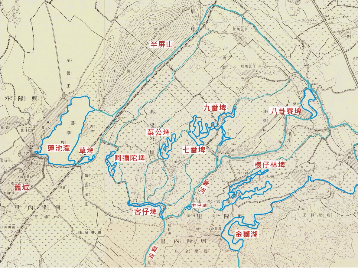
日治時期左營埤塘分布圖 (底圖﹕1904年《台灣堡圖》,郭吉清加註)
The distribution of ponds in Zuoying during the Japanese Colonial Period (A snapshot of 1904 Taiwan Hozu with labels added by Ji-cing Guo)
隨著城市開發腳步極速的前進,都市土地寸土寸金,「文化資產保存」概念往往不敵經濟價值優先考量的傳統思維,因此,水圳與埤塘的保存更需要大量優質的城市公民,不斷努力的倡議與宣傳,以期共創「水與綠」的優質城市生活環境﹗
To accommodate rapid urban development, land in urban areas has become increasingly expensive. The preservation of cultural assets is often overshadowed by the imperative for economic growth. In this context, it requires the collective effort of exemplary urban citizens to advocate for and promote the preservation of canals and ponds, creating a quality urban living environment characterized by abundant water resources and green spaces!